|
Davies Surveys Ltd has the capability to offer many different surveying diciplines. Our team of highly experienced surveyors are fully competent in all aspects of land, building and engineering works.
|
Call 02920 811000
[email protected] |
|
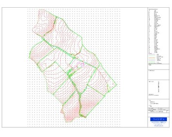
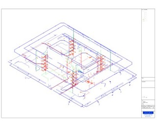
Topographical Surveys
Using the latest Trimble robotic total stations and GPS we can provide topographical surveys to suit every clients requirements, with all our surveys being related to Ordnance Survey datum and national grid. Non contact reflectorless technology allow remote measurement of features such as buildings, ridges and eaves without gaining physical access to those areas. The fully automated survey process we utilise via Trimble loggers and LSS sorftware enables us to provide quick and accurate surveys to every client from single plot self build to blue chip multinational. We have experience in the the following areas.
|
click image for pdf file
click image for pdf file
|
click image for pdf file

click image for pdf file
|
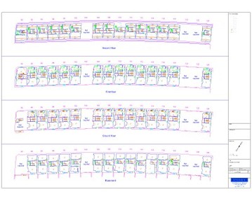
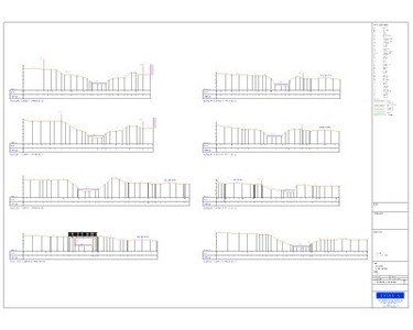
Building Surveys
Floorplans - Elevations - Sections - BIMs At Davies Surveys we pride ourselves on the quality of our building surveys. We are equipped to cope with all levels from small domestic properties to large industrial buildings. Our floorplans are drawn continuously on site using MBS software, Trimble reflectorless total stations and Leica distos allowing onsite checking in real time. These features allow us to leave site confident of the survey regardless of the shape and size of the structure.
|
|
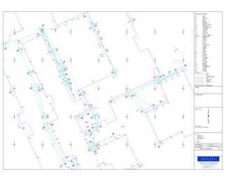
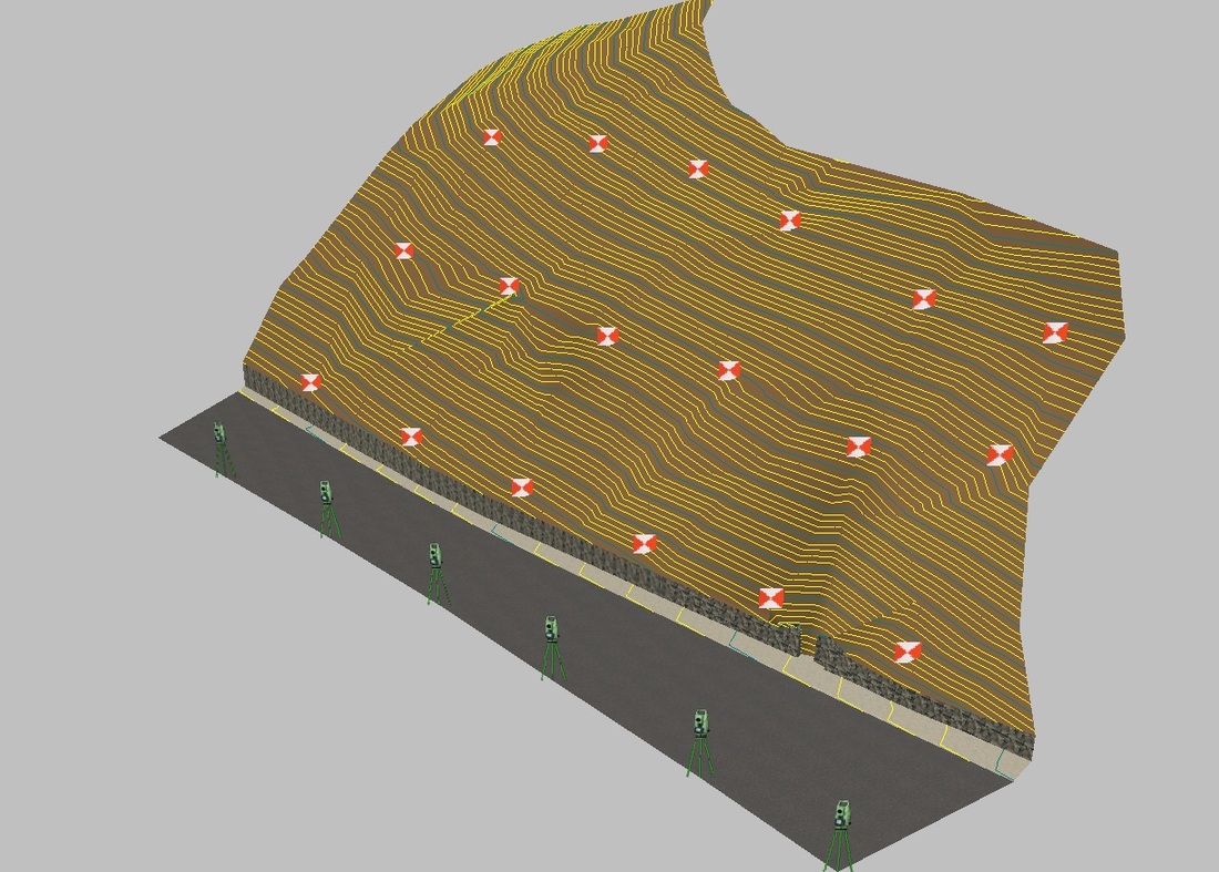
Drainage Surveys
Where possible and practical we aim to investigate all drainage on our sites. This enables us to supply drainage information including cover locations, cover levels, invert levels, pipe sizes, connectivity and flow directions. Working together with CCTV information we can provide a complete drainage service. We are also experienced in producing 3D models highlighting drainage networks and other arterial services running throughout buildings.
|
click image for pdf file
click image for pdf file
|
click image for pdf file
|
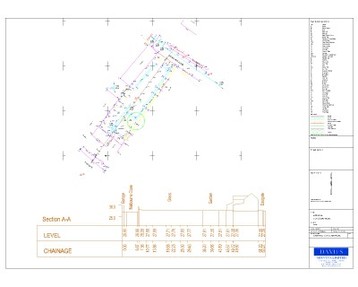
Hydrographic Surveys
At Davies Surveys we are experienced in river and hydrographic surveys. We can produce all surveys as plan, cross sections or 3D models.
|
|
Monitoring Surveys
We undertake monitoring surveys where movement is thought to be taking place. By logging accurate data on a number of site visits we can analyse sets of recordings to assess if movement is occurring.
|
|
click image for pdf file
|
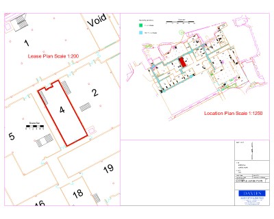
Land Registry Plans
We can produce survey lease plans for a full range of properties and sites.
|
|
|
